
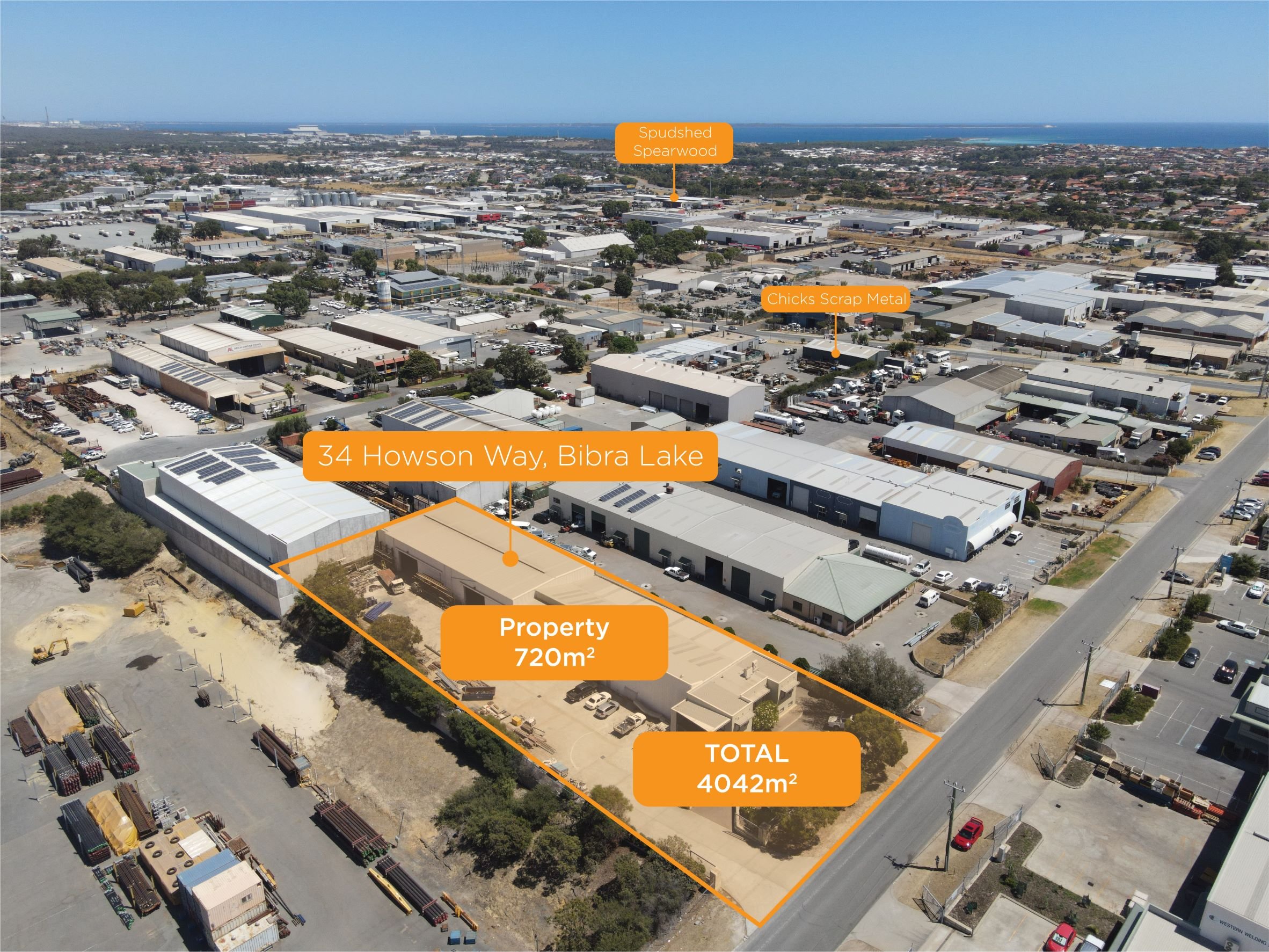
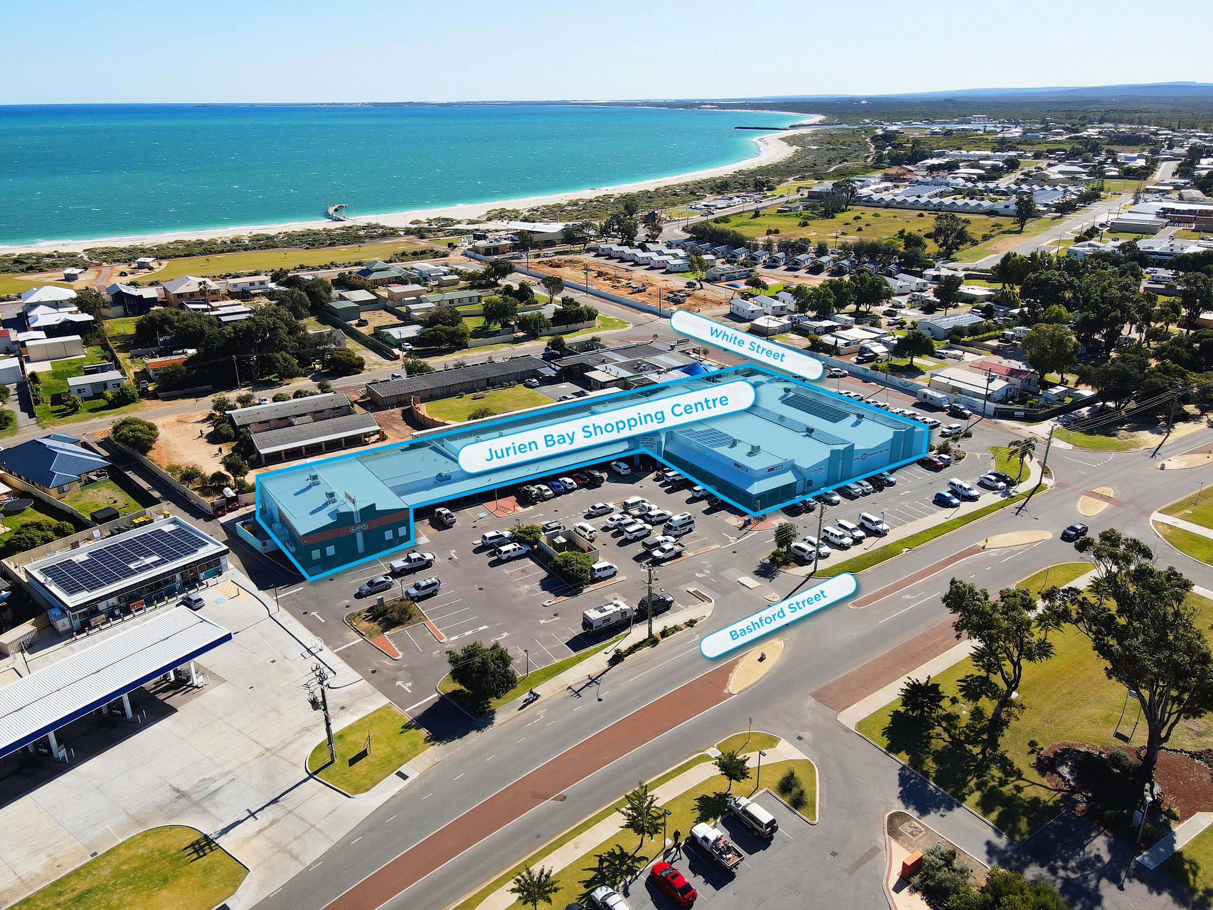
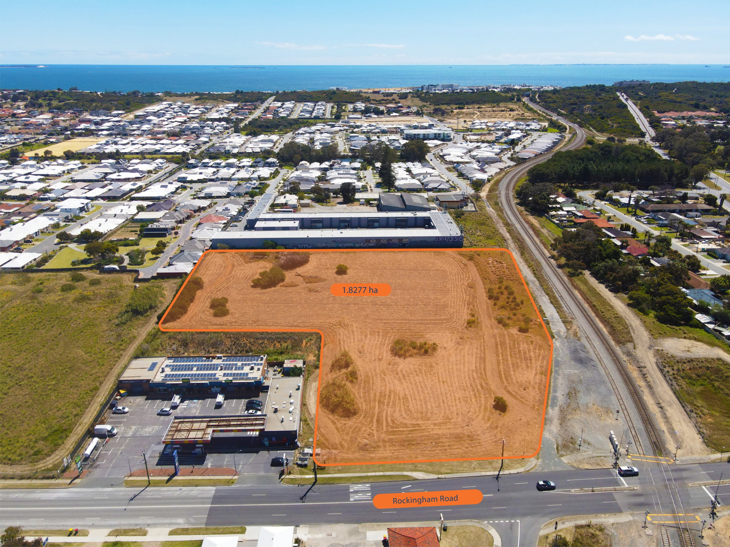
Demonstrate the full scope and potential of a property with aerial photography
Our photos are edited and colour corrected for maximum impact, and can be marked up with lot boundaries, land areas, or different buildings or facilities on-site. Tagging surrounding points of interest will help prospects understand whether the area is suited to their needs.
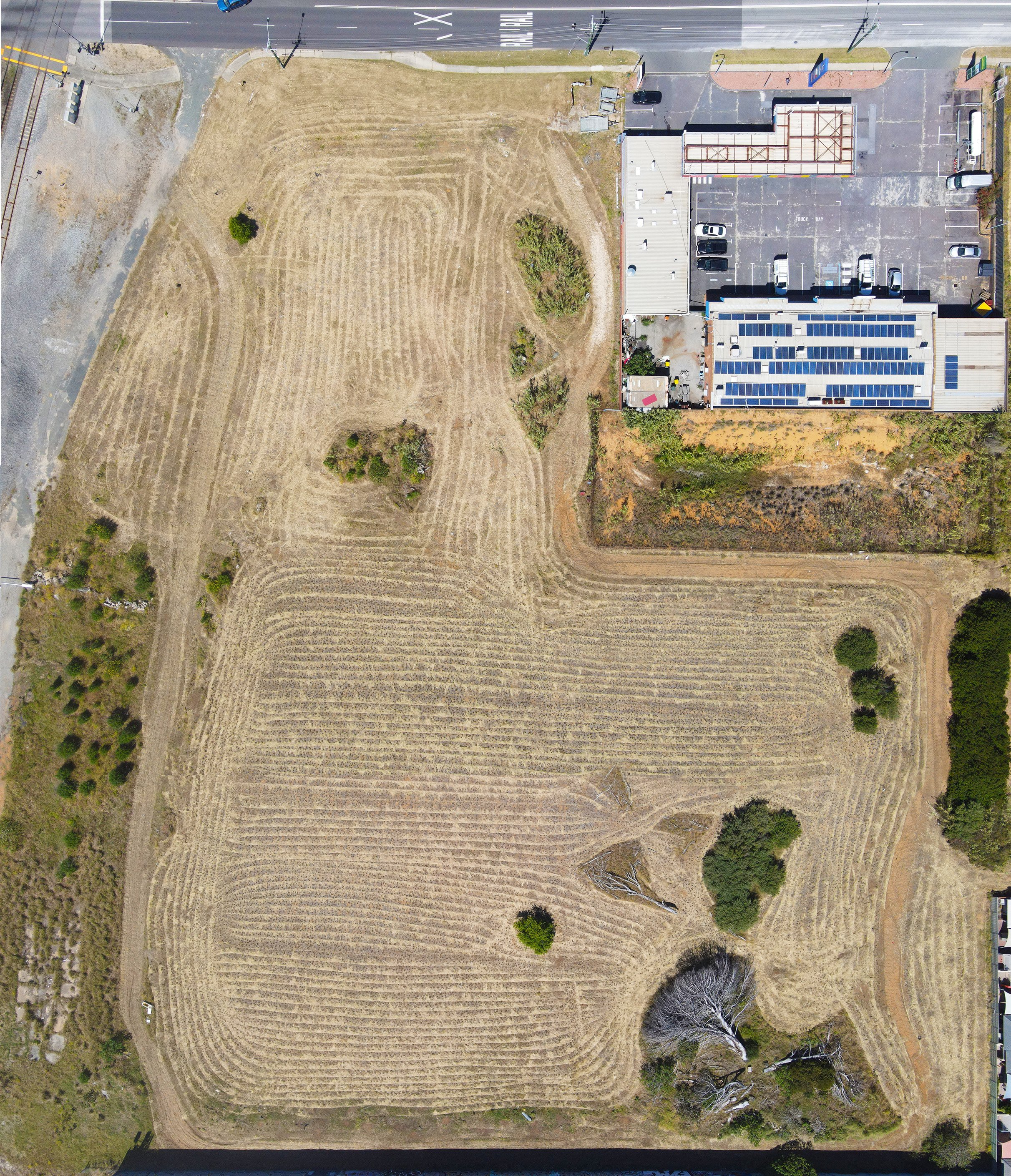
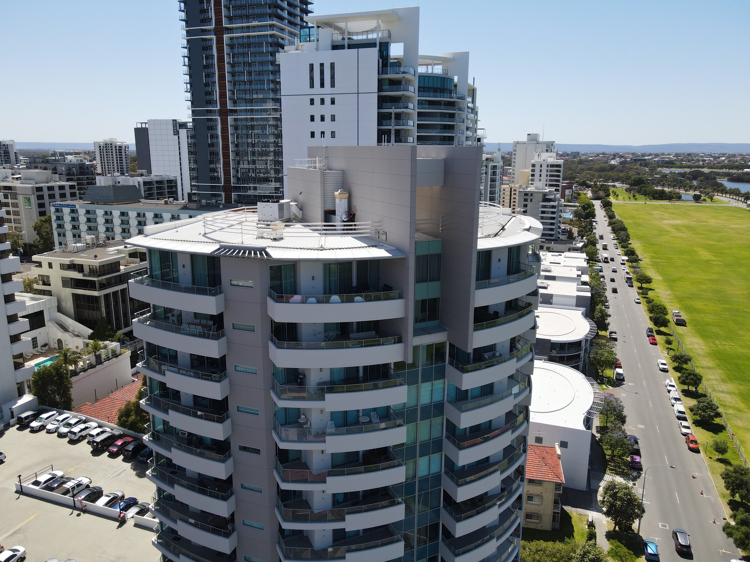
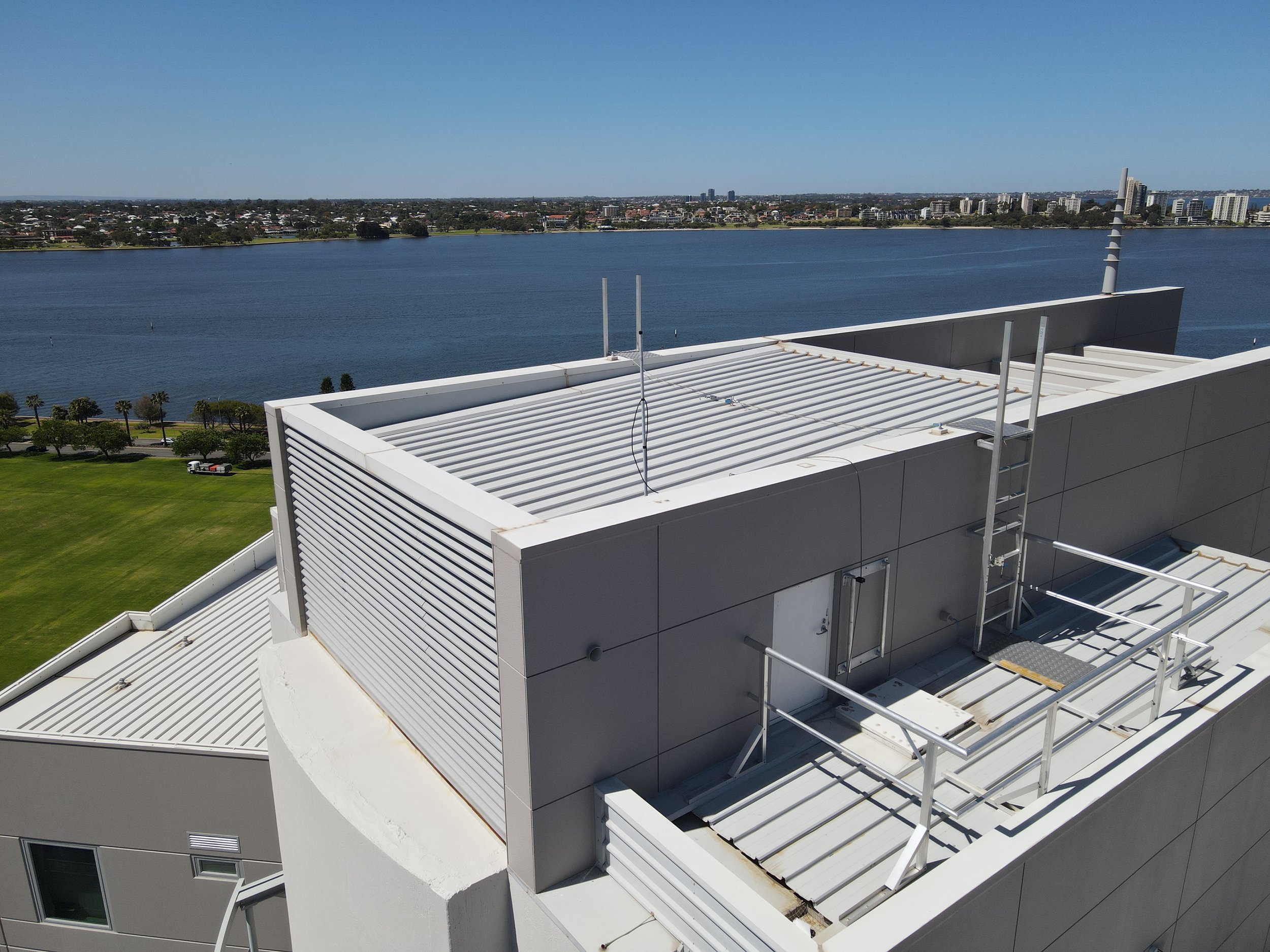
Easily inspect difficult to access areas
Drone photography can supplement a condition report to inspect difficult to access areas such as roof tops, air conditioning, or ventilation. Drones can quickly reach areas that would be too costly or hazardous and would otherwise be left out of reporting.
Supplement your insurance valuation and make certain you are adequately covered

An aerial view can identify nearby features which could create risks and impact the value of a property for insurance purposes. When completed alongside a full insurance valuation inspection, we can advise on replacement cost valuation so you aren’t exposed to a risk of under-insurance.